
Lesson 5 of 15 Part 2: Why the levees broke
The 17th Street Canal
The breach that flooded Lakeview — and much of the city's main basin — is the most clear-cut and most non-controversial example of federal negligence in levee building.
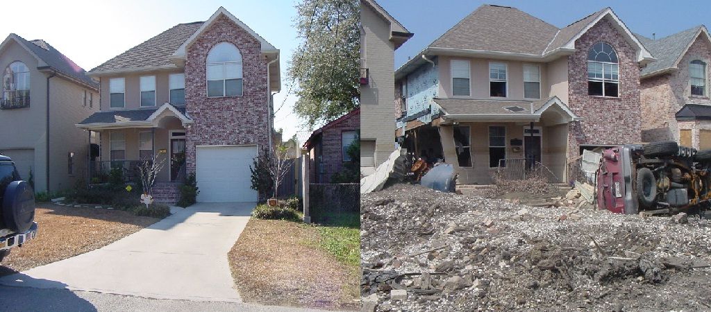
The day before Hurricane Katrina’s storm surge arrived, the Lakeview neighborhood in western New Orleans was a densely populated area of primarily middle- to upper-class, white homeowners. Houses filled the area right up to the levee of the 17th Street Canal, which was — and still is — the largest and most important drainage canal for the city of New Orleans.
Operating with Pump Station 6, at that time the largest pump station in the world, the canal could move up to 9,200 cubic feet of water per second. Huge 50-year-old oak and pecan trees grew at the base of the canal’s levee and throughout the neighborhood.
The breach
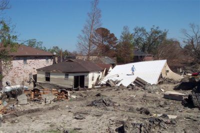
On August 29, 2005, between 8:45 and 9:45 a.m., a concrete levee monolith — a 30-foot-long section of floodwall — failed and released floodwater into Lakeview. At the moment of failure, the water level was about 2.6 feet lower than the top of the wall. The pressure of the water did not exceed the design safety limit.
The remaining monoliths washed away, one by one, in the flowing water. The breach quickly expanded into a 450-foot-wide gap through which storm surge water poured, killing hundreds directly and indirectly, destroying hundreds of residences, and causing millions of dollars in property damage. The flooding extended through Lakeview and also Lakewood North and South, Broadmoor, Mid-City, Old Metairie, Leonidas, Gert Town, Hollygrove, portions of Uptown and Carrollton, and more.
How did this happen?
In 1965, Hurricane Betsy demonstrated that a major hurricane could overtop the earthen levees of the 17th Street Canal. The Army Corps initially reviewed five plans to solve the problem, eventually narrowing its recommendations to two, as is common practice. Right-of-way was a significant hurdle, as homes were built very close to the levees.
- Plan 1, the high walls plan: strengthen and raise the height of the levees by installing floodwalls.
- Plan 2, the gates plan: install floodgates at the canal’s mouth at Lake Pontchartrain.
Records show that the Army Corps felt both plans were equally reliable. (It is instructive to note that the gates plan did not include auxiliary pump stations like those in place today.)
For the 17th Street Canal, the cost of each approach was about the same. The Army Corps ultimately elected to raise the levees using floodwalls, in part because the Orleans Levee Board and the Sewerage and Water Board of New Orleans preferred it. Among other concerns, the local agencies viewed the floodgates plan as incompatible with their responsibility for draining rainwater out of the city.
So the Corps itself recommended the high walls plan here. Then it built those walls with steel sheet pilings that were too short.
The breach of the 17th Street Canal is the most clear-cut and most non-controversial example of federal negligence in its levee building.— Levees.org, August 29, 2013
All post-Katrina levee investigations conclude that the breach was due to driving steel sheet pilings to depths that were too shallow. In recommending I-walls with such short sheet pilings, the Army Corps had relied upon the poorly executed and misinterpreted E-99 study it had conducted near Morgan City. At a savings of $100 million, the Army Corps wrongly concluded it could drive the steel pilings of the 17th Street Canal to depths of not more than 17 feet instead of between 31 and 46.
The Army Corps’ design and construction blunders doomed the citizens of New Orleans. In hindsight, there was no question that the 17th Street Canal would fail. The only questions were when and where. On August 29, catastrophic failure occurred on the New Orleans side of the canal when the levee supporting the steel and concrete floodwall slid sideways — trees and all — on top of the organic and slippery soil remnants of an ancient bayou.
Post-Katrina investigators also observed some movement of the floodwalls on the Jefferson Parish side of the canal. It is fortunate the canal wall did not breach on both sides. That would have flooded the suburban city of Metairie, reducing the drier land available after the storm.
What about the seepage?
It is household knowledge in New Orleans that in the months before the storm, residents living next to the 17th Street Canal reported water pooling in their yards. Records show that the city tested the water six months before Katrina and determined it was coming from the canal. The Army Corps was never alerted.
Was that seepage the canary in the coal mine? Probably not. The seepage was about 800 feet from the initial breach site — a long distance in geotechnical engineering — and was most likely due to a very localized condition unrelated to the design flaw. Three of the major post-mortem studies do not even mention it.
And any attempt to pass the buck for the 17th Street Canal to the local levee district assumes the Corps would have responded by ripping out miles of floodwalls completed at enormous expense in the year 2000 and driving new sheet piles 50 feet down — at breakneck speed. That is not reasonable. People protected by levees are better served by focusing on the true causes of the flood rather than the imagined ones.
In court
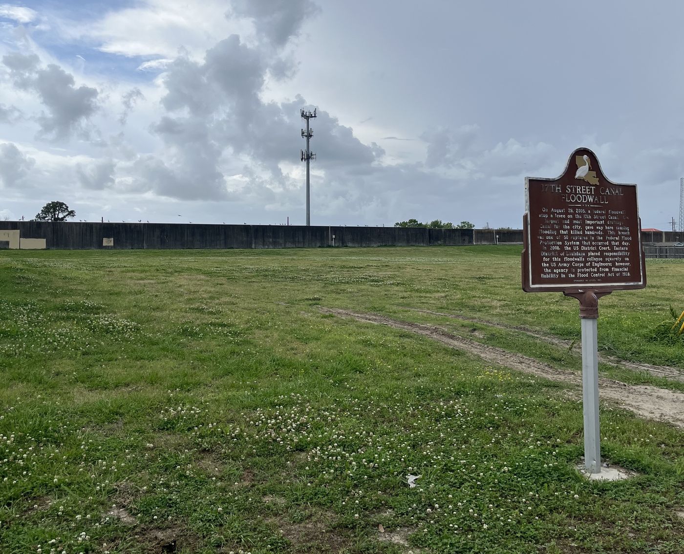
In January 2008, federal Judge Stanwood Duval of the U.S. District Court for the Eastern District of Louisiana held the U.S. Army Corps of Engineers responsible for defects in the design of the concrete floodwalls constructed in the levees of the 17th Street Canal. However, the agency could not be held financially liable due to sovereign immunity provided by the Flood Control Act of 1928. (More on that in the lesson In court.)
The site today
The repaired breach site now consists of a different, sturdier design called a T-wall. Twenty years later, the adjacent lots on Bellaire Drive are void of homes, buildings and trees. A Louisiana State Historic Plaque — the first one Levees.org ever installed, unveiled on August 23, 2010 — stands at ground zero.
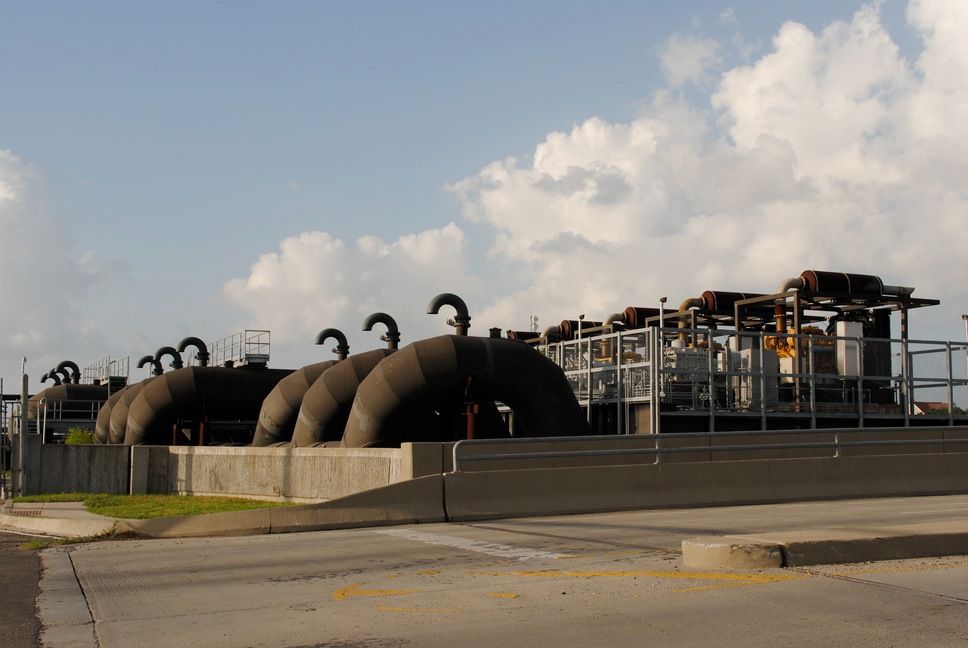
Since 2005, the Army Corps has strengthened the levees and floodwalls of the 17th Street Canal in four ways:
- Gates with massive pump stations have been installed at the canal’s mouth on Lake Pontchartrain.
- The Corps has designated a “safe water” level in the canal that is lower than the height of the canal wall.
- The levees have been strengthened by mixing soil with cement and pumping the slurry back into them.
- Relief wells that act as “warning gauges” have been installed.
The 17th Street Canal was not the only place where short sheet piles gave way that morning. A few miles east, the same mistake was waiting at the London Avenue Canal — and there, the walls failed on both sides.
Go deeper
Sources
- IPET Final Report, Volume 5
- In re Katrina Canal Breaches Consolidated Litigation, U.S. District Court, Eastern District of Louisiana, Judge Stanwood Duval, January 2008
- Woolley & Shabman, Decision-Making Chronology (2008)