
Lesson 7 of 15 Part 2: Why the levees broke
The Industrial Canal and the Lower Ninth Ward
The first floodwater of the morning came through the Industrial Canal, which breached in nearly the same place it had during Hurricane Betsy 40 years earlier. The Lower Ninth Ward went under 6 to 12 feet of water.
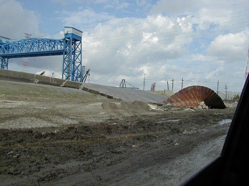
The historic Lower Ninth Ward mostly sits on Mississippi River levee material — some of the higher ground in the city. In the mid-1800s, working-class African Americans and immigrant laborers from Ireland, Germany, and Italy seeking affordable housing migrated to the area. In this rural setting, residents enjoyed access to fishing grounds and grew okra and other vegetables.
A canal that split a neighborhood
In 1923, the 5.5-mile-long Industrial Canal — formally the Inner Harbor Navigation Canal — opened, connecting Lake Pontchartrain to the Mississippi River. Equipped with a massive lock, the canal let large cargo ships and barges reach river wharves. It separated eastern New Orleans from the rest of the city and split the Lower Ninth Ward away from the Upper Ninth Ward.
In September 1965, Hurricane Betsy pushed storm surge into the Industrial Canal. The east side breached in the same general area where it would breach again 40 years later. Eighty percent of the Lower Ninth Ward went under water, and the city reported 81 deaths.
Up until 2005, the Lower Ninth Ward kept its mixed population of socioeconomically disadvantaged and middle-class residents, predominantly African American. Immediately before Katrina, the area in front of the east breaches was a dense, thriving neighborhood of primarily African American, lower- to middle-class homeowners. Houses were built right up to the canal levee and were shaded by huge oaks, cypresses and pecans.
The breaches
On August 29, 2005, at about 4:30 a.m., water blew out a sandbag plug where the CSX Railroad crosses the northern arm of the Industrial Canal’s west side. A gate was missing there, because it had been damaged by a train derailment and was still under repair. Water flooded the Upper Ninth Ward, Bywater and Tremé.
At about 5:00 a.m., a breach in the east bank of the Industrial Canal started the first flow of floodwaters into the Lower Ninth Ward.
At about 7:30 a.m., another large floodwall breach opened on the east side, when the Army Corps’ lock gauge was reading about 12.5 feet. Water overtopping the canal wall had scoured a trench behind it, causing failure. Many Lower Ninth Ward residents reported hearing an explosion and seeing a “wall of water.”
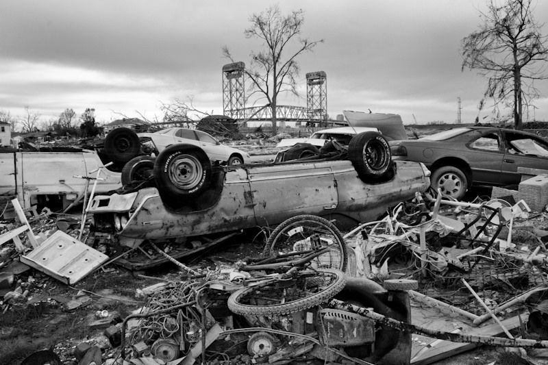
Floodwaters from the two east-side breaches combined and submerged the entire Lower Ninth Ward under 6 to 12 feet of water, killing hundreds directly or indirectly and destroying homes and infrastructure. The water reached neighboring St. Bernard Parish, including Arabi and Chalmette.
On the west side, the flooding directly hit mainly commercial buildings, but it extended to residential neighborhoods including the Upper Ninth Ward, Pontchartrain Park, Gentilly Woods, St. Claude and St. Roch. These floodwaters combined with water released from the 17th Street and London Avenue Canals to flood most of the city’s main basin.
Why it failed
Post-Katrina studies concluded that the Industrial Canal’s I-walls were overtopped — a situation made worse by the surge-amplifying “funnel” formed by the levees along two federal navigation channels, the Mississippi River Gulf Outlet (MR-GO) and the Gulf Intracoastal Waterway (GIWW). This funnel effect had been predicted by many scientists. Where the two channels meet, their levees trap storm surge and shoot it toward the Industrial Canal.
But overtopping is not the whole story. The overtopping water scoured trenches behind walls that had no erosion protection. The first independent levee investigation found that some of these failures “could have been prevented at little incremental cost if erosion protection had been emplaced along the back side of the concrete floodwall.” It also found the sheet piles here, “like many sections of the flood protection system,” were too shallow. Raymond Seed, the investigation’s co-chair, later said the shallow sheet pile depths led directly to the north breach by the Lower Ninth Ward.
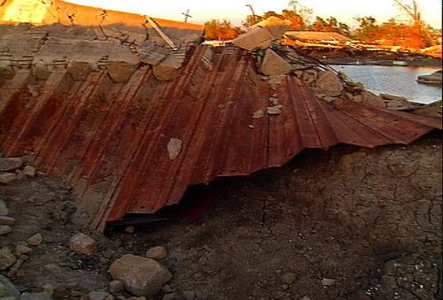
Before the water reached the top “The spectacular northeast breach of the Industrial Canal occurred before water reached the top of the floodwall. Sheet pilings remained interconnected.” — Levees.org caption for the photo by Roy Arrigo, 2012
The barge
Before the storm, an empty barge owned by Ingram Marine had been moored across from what would become one of the breach sites. At some point it came loose, and after the eye of the storm had passed, it was pushed across the Industrial Canal, floated through the southeast breach and was deposited in the Lower Ninth Ward. When the area re-flooded during Hurricane Rita on September 23, the barge refloated and came to rest on top of a school bus.
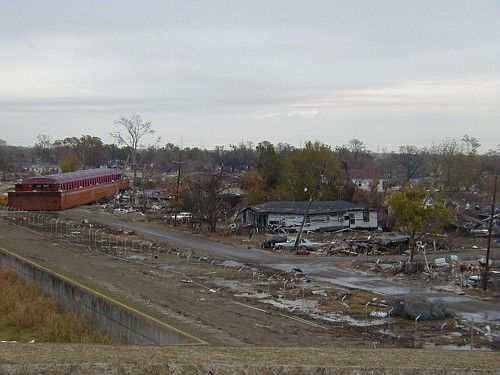
The barge became an icon of the disaster. In January 2011, federal Judge Stanwood Duval ruled that the company responsible for its mooring was not liable for damage.
What it looks like now
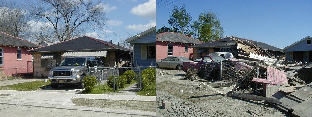
Such deforestation changed the texture of neighborhoods here and throughout the city. Today, the land next to the breach is largely vacant of homes and buildings. Many foundations or slabs where homes once stood are all that remain. The trees are gone — lost to the flooding or removed by government agencies afterward.
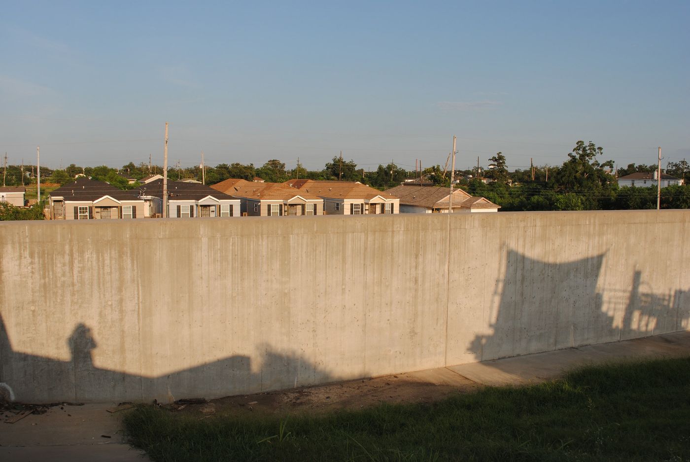
Since 2005, the Army Corps — at a cost of $1.1 billion — has built a storm surge barrier near the confluence of the GIWW and MR-GO. Called the Lake Borgne Surge Barrier, it is more than a mile long, with two 150-foot-wide navigable floodgates on the GIWW and a 56-foot-wide gate on Bayou Bienvenue. Together with the Seabrook gates, the barrier is designed to keep storm surge from entering the Industrial Canal.
On August 24, 2015, Levees.org unveiled a historic plaque at the Industrial Canal breach site, made possible with the guidance and input of stakeholder leaders in the Lower Ninth Ward.
The funnel that pushed surge into the Industrial Canal was built by the Army Corps, too. In the next lesson, we follow those navigation channels east and south — to New Orleans East and St. Bernard Parish.
Go deeper
Sources
- Independent Levee Investigation Team (ILIT), Investigation of the Performance of the New Orleans Flood Protection Systems, 2006
- In re Katrina Canal Breaches Consolidated Litigation (MR-GO case), Judge Stanwood Duval, November 2009