
Lesson 2 of 15 Part 1: What happened
The morning the levees broke
From a forecast that surprised everyone to the most successful rapid evacuation of a major city in U.S. history — and then a morning when the walls gave way, one after another.
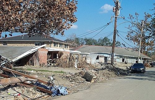
On Friday, August 26, 2005, many New Orleanians — including Levees.org founder Sandy Rosenthal — believed Hurricane Katrina was heading toward the middle of the Florida Panhandle. Then came the big shock.
Friday: the forecast moves
During the day on Friday August 26th, some of the computer models shifted the storm’s track, now a hurricane, west. Then, late in the afternoon, all models shifted in unison, and New Orleans was moved to the center of the cone of certainty. Governor Blanco declared a state of emergency at 4:00 p.m.
By 7:00 a.m. on Saturday (August 27), the hurricane was over the center of the Gulf of Mexico. At first, the eye started to disintegrate, normally a sign of weakening, but, in this case, it was redistributing. Wind speed picked up around the central vortex, and pressure fell again. Later, the eye contracted, and masses of thunderstorms sprang to life. Within a few hours, the storm doubled in size, eclipsing most of the gulf. — Sandy Rosenthal, Words Whispered in Water, Chapter 1, “Goodbye New Orleans”
Saturday: the evacuation
Throughout the day on Saturday, radio and television reports urged residents to evacuate. Officials for Plaquemines and St. Charles Parishes, low-lying coastal areas south of New Orleans, ordered mandatory evacuations. Governor Blanco ordered contraflow, and by 4:00 p.m. the state police had reversed all inbound lanes.
Contraflow turns all lanes of the interstate and the Causeway Bridge over Lake Pontchartrain into one-way roads, with all lanes outbound from the city. The concept is simple and ingenious, but the devil is in the details. It requires pristine coordination between the parish governments and the state police.
Louisiana had tried it for the first time a year earlier, for Hurricane Ivan. That trial went badly: traffic delays of up to 12 hours, and up to 20 hours for those evacuating to Texas. Many turned around and went home to watch Ivan sputter and weaken. But Ivan exposed a contraflow plan badly in need of revision. For Katrina, phased evacuations began 50 hours in advance in the lowest-lying parishes and 30 hours in advance for the New Orleans metro area, and the improved contraflow resulted in only two- to three-hour delays.
Governor Blanco’s evacuation of 93 percent of the New Orleans region would be cited as the most successful rapid evacuation of a major city in U.S. history.
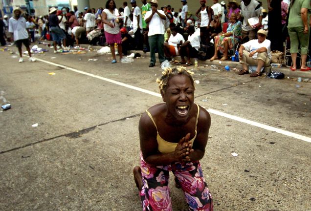
That is not to say the evacuation was perfect. In hindsight, not nearly enough planning was directed toward those without a car, credit cards, road experience, and a network of family and friends elsewhere. Many stayed to care for their pets and perished with them.
That night, Max Mayfield, director of the National Hurricane Center, did something he rarely does. He called the governors in the cone of certainty to warn them. Upon urging from Governor Blanco, he also called Mayor Nagin and told him that some levees in the greater New Orleans area could be overtopped — that water could pour over the top.
What no one was told
Here is a fact that is often forgotten: even the most desperate appeals to residents from local, state, or federal officials did not warn that the levees could breach and fail.
The first suggestion that levees could fail came at 1:47 a.m. on Monday, in a memo from the Homeland Security Operations Center to the White House Situation Room — six hours after the evacuation was already completed.
Pulitzer Prize-winning reporter Mark Schleifstein co-wrote “Washing Away,” a five-part series in 2002 that predicted massive flooding of New Orleans in a direct hit from a powerful hurricane. Years later, he told a room of journalists:
But what we didn’t know was that the levees could actually breach and fail. We knew the levees could get over-topped by storm surge, but we never imagined what we saw during Katrina. — Mark Schleifstein, Society of Professional Journalists convention, 2011
This matters, because in the weeks after the flood, members of Congress blamed the people who stayed behind. One week after Katrina, Senator Rick Santorum recommended penalties for New Orleans residents who did not evacuate. That attitude sprang from the wrong-headed belief that residents knew this sort of disaster could happen and chose to stay anyway. They did not know. Nobody told them.
Monday morning: the walls give way
In the words Sandy Rosenthal used at Levees.org’s first rally five months later, “Katrina missed metro New Orleans. We sustained the winds of a Cat 1 and the storm surge of a Cat 2 yet levees broke all over the city — many without being over topped.” What followed was a chain of failures in the federal hurricane protection system, spread across the morning.
- About 4:30 a.m. — Water blew out a sandbag plug where the CSX Railroad crosses the Industrial Canal. A floodgate was missing there; it had been damaged by a train derailment and was still under repair. Water poured into the Upper Ninth Ward, Bywater and Tremé.
- About 5:00 a.m. — A breach in the east bank of the Industrial Canal started the first flow of floodwaters into the Lower Ninth Ward.
- Early morning — Along the Mississippi River Gulf Outlet and the Gulf Intracoastal Waterway, levees built with sand and shell were washed away, flooding New Orleans East and St. Bernard Parish.
- About 7:30 a.m. — Another large floodwall breach opened on the east side of the Industrial Canal. Many Lower Ninth Ward residents reported hearing an explosion and seeing a “wall of water.”
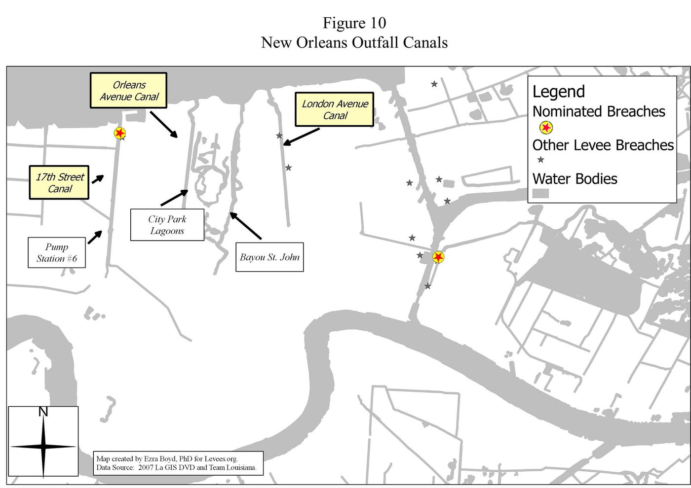
- Mid-morning — Floodwalls failed on both sides of the London Avenue Canal, sending torrents of water and sand into Gentilly and Lake Vista.
- Between 8:45 and 9:45 a.m. — A 30-foot section of floodwall on the 17th Street Canal failed. The breach quickly expanded into a 450-foot-wide gap. Water poured into Lakeview and, over the following days, much of the city’s main basin.
By the time the water stopped rising, 80% of New Orleans was underwater. Virtually 100% of St. Bernard Parish was underwater. Over the next three days, about 80% of the floodwater that filled the city’s main basin came through the three breaches on the 17th Street and London Avenue Canals.
The people in the water
The breaches did not affect everyone equally. A study of the dead published in 2009 showed that most victims were elderly or lived near breach sites. In the town of Violet in St. Bernard Parish, 35 elderly nursing home residents drowned in quickly rising water. Their caretakers had sheltered in place with them, fearing the frail residents could not survive an evacuation — and the area had not flooded during Hurricane Betsy in 1965.
Levees.org was born out of what happened next. On Halloween Day 2005, nine weeks after the levee failures, Sandy Rosenthal realized she had to do something about the myths that were taking root — mainly, the myth that the residents of greater New Orleans understood the risk they faced and thus were foolish to live there. Engineer and blogger Matt McBride later put it this way:
The issue is whether the citizens of the greater New Orleans area were fully informed of the risks arising from the inadequate engineering of those walls and levees. And the answer is they were not. — Matt McBride, on Levees.org, 2011
To understand why the walls failed, we first need to know who built them. That is the subject of the next lesson.
Go deeper
- The day the Hurricane Katrina forecast model surprised everyoneAn excerpt from Words Whispered in Water.
- Even the most insistent calls to evacuate before Katrina did not warn the levees could break
- Stopping Katrina Myths From Becoming Household Knowledge
- Levee Exhibit: The Evacuation of New Orleans for Katrina
Sources
- Sandy Rosenthal, Words Whispered in Water: Why the Levees Broke in Hurricane Katrina (Mango, 2020; Turner, 2025), Chapter 1
- John McQuaid and Mark Schleifstein, Path of Destruction (Little, Brown, 2006), p. 179
- Robert Verchick, Facing Catastrophe (Harvard University Press, 2010)
- Catastrophe in the Making (Island Press, 2009), p. 19