
Lesson 3 of 15 Part 1: What happened
A federal project
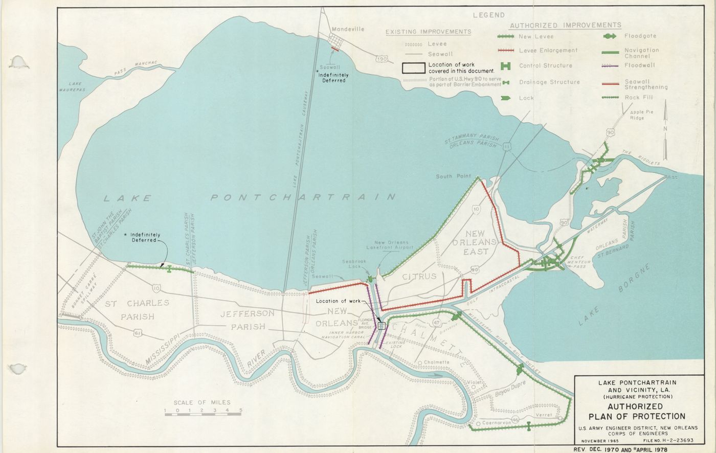
After Hurricane Betsy in 1965, Congress made the U.S. Army Corps of Engineers solely responsible for designing and building the hurricane protection around New Orleans. Forty years later, it still wasn't finished.
New Orleans is often described as a bowl, sitting below sea level, that never should have been built. The truth is more interesting — and it points to a federal responsibility that many Americans never learned about.
A city on high ground
The original residents settled on the high ground along the Mississippi River, created by flooding over thousands of years. Other neighborhoods were built atop “ridges” that are the ancient banks of rivers and bayous. Gentilly Road was built on one of these ridges and formed the eastern path into the oldest part of the city.
Half of New Orleans is at or above sea level, according to an April 2007 report by Richard Campanella with the Center for Bioenvironmental Research at Tulane and Xavier universities. On the at-and-above sea level list are greater Carrollton, River Bend, Audubon, University, Uptown, the Garden District, the Lower Garden District, the Irish Channel, the French Quarter, Tremé, Bayou St. John, the Marigny, Bywater, Holy Cross, Algiers Point, and the lakefront neighborhoods of Lakeshore, Lake Vista, Lake Terrace and Lake Oaks.
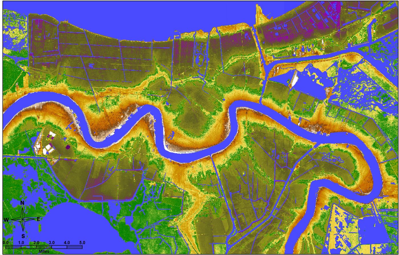
How did the rest of the city get so low? Later developments extended toward Lake Pontchartrain, and navigable commercial waterways ran from the lake to downtown. After 1940, those waterways were closed because the new Industrial Canal carried waterborne commerce. Once they were closed, the city’s drainage system drastically lowered the water table, and some areas settled several feet as the organic soils beneath them consolidated. After 1965, the Army Corps built a levee system around a much larger geographic footprint that included former marshland and swamp.
A coast that was predicted to sink
The region’s vulnerability due to manmade interference was predicted with remarkable candor more than a century ago. In December 1897, civil engineer Elmer L. Corthell wrote in National Geographic that withholding the river’s sediment from the delta with levees, combined with the “steady, though slow, subsidence of these areas,” should be weighed in deciding how to protect the people. One day, he predicted, the people of the whole United States “can well afford, when the time comes, to build a protective levee against the Gulf waters.”
The twentieth century accelerated that loss. Dams and flood control structures north of New Orleans starved Louisiana of land-building sediment. About 10,000 miles of navigation canals dug into Louisiana’s coastal wetlands for oil and gas exploration damaged or killed the state’s natural barriers to storm surge. When the hurricane levees were first designed in the 1960s, there were 100 miles of marshes between them and the Gulf of Mexico. By 2005, much of that buffer was gone.
Hurricane Betsy and the Flood Control Act of 1965
In September 1965, Hurricane Betsy pushed storm surge into the Industrial Canal. The east side breached in the same general area where it would breach again 40 years later. Eighty percent of the Lower Ninth Ward went under water, and the city reported an official count of 81 deaths. Betsy also demonstrated that a major hurricane could overtop the earthen levees of the city’s drainage canals.
Congress responded with the Flood Control Act of 1965. It authorized the Lake Pontchartrain and Vicinity Hurricane Protection Project and ordered the U.S. Army Corps of Engineers to be the sole authority for its design and construction. That mandate remains in place today.
Who does what The U.S. Army Corps of Engineers designs and builds the hurricane protection, controls the contracts for that work, and writes the instructions for maintaining it. More than 98% of Corps employees are civilians.
Local levee boards (before 2006, the Orleans Levee Board and its neighbors) are the “local sponsors.” They pay a share of the cost, operate gates when storms approach, and maintain completed structures — mainly cutting grass, removing vegetation and debris, and watching for seepage.
Before 1965, the local levee boards built their own levees, and never was there a disaster even close to what happened once the Army Corps took over. Relieved of design and construction, the historic boards’ role became maintenance. In time, they became a source of patronage, and some state money may have been diverted to projects unrelated to flood safety. But such diversion has never been shown to be relevant to the flood protection failures. As Levees.org has put it: blaming the local levee board for the levee failures is like blaming the janitor if a building falls to the ground.
Forty years and still not finished
The Corps’ pace was glacial. In 1982, the federal General Accounting Office (GAO) issued a report to the Secretary of the Army that, even in its neutral “government speak,” reprimanded Army Corps officials for how slowly they were building the levee protection for New Orleans in light of the critical need for completion. The Orleans Levee Board had complained to Congress, and the GAO asked the Secretary of the Army to take specific steps to resolve the issue.
When Hurricane Katrina arrived 23 years later, the project was still not complete. Along the critical 11-mile northeast flank of the St. Bernard and Lower Ninth Ward basin, large portions of the levee were several feet below their final design grade, according to the first independent levee investigation; funds the Corps had requested had not yet been approved by Congress. Either way, the responsibility was federal.
A margin of safety fit for cattle
The design standards themselves were weak. Robert Bea, the Berkeley engineer who co-led the first independent levee investigation, explained that in the offshore oil industry, structures in the Gulf are built with a safety factor of four to six. The safety factor for New Orleans levees was 1.3. Bea and his team traced that figure back to the 1940s, when the Corps used a 1.3 safety factor to protect agricultural land — cows, in other words.
By applying the same standard to city levees, the Corps has effectively been treating the people of New Orleans “as if they were as valuable as cattle.” — Fortune Magazine, “The long, strange resurrection of New Orleans,” 2006
The Corps also designed for a “standard project hurricane” that was too weak a storm. In 2007, an expert panel of the American Society of Civil Engineers estimated that New Orleans residents’ pre-Katrina risk was 1,000 times higher than what is considered minimally acceptable for a major U.S. dam.
None of this was the local levee board’s doing. It was a federal project, designed and built by a federal agency, to federal standards. In the next part, we look at exactly how — and why — it failed.
Go deeper
Sources
- Richard Campanella, Center for Bioenvironmental Research at Tulane and Xavier Universities, analysis of above-sea-level New Orleans, April 2007
- U.S. General Accounting Office, Improved Planning Needed by the Corps of Engineers to Resolve Environmental, Technical, and Financial Issues on the Lake Pontchartrain Hurricane Protection Project, August 17, 1982
- Elmer L. Corthell, National Geographic, December 1897, p. 354